Easy Rider 2006: Day Two, Lewiston to Blackfoot
 The shape of Idaho is somewhat like that of a letter "L". Our route was very much "L" shaped today, and at times it felt like "'ell" too. Our route from Lewiston, up along the Washington/Idaho border, to Blackfoot in far south-east Idaho, took us through some very wonderful scenery, and some absolutely awful weather in a total ride of 546 miles in an "L" shape if you follow on a map.
Curiosity about long-distance motorcycle riders tends to invite questions and start conversations with everyone from desk clerks to people in line at the freebie breakfast buffet that, along with free wireless Internet, is the calling card of today's modern road side lodge. In the old days along Route 66 when American was traveling in the 30s, and 40s, "modern" meant air-cooled and car port. In the 50s, it was a phone, and in the 60s, color TV. Today its free breakfast and high-speed Internet...but I digress.
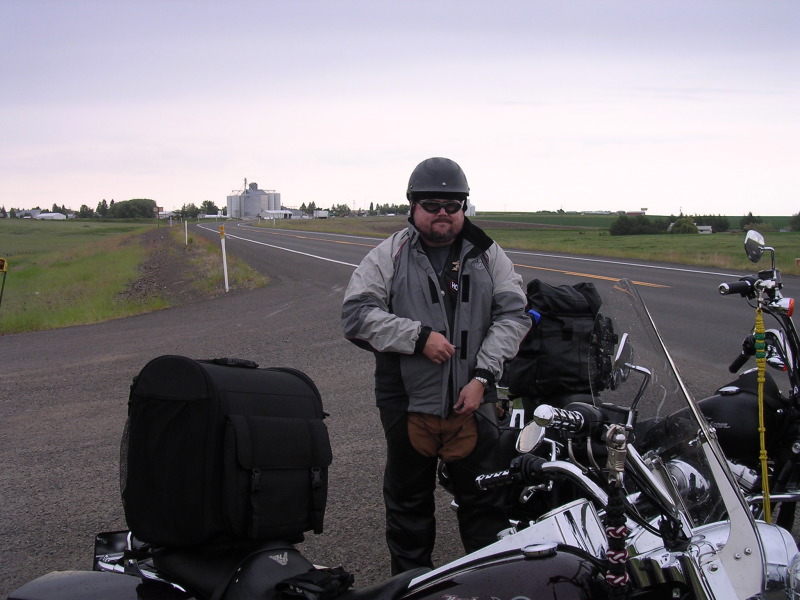
The point I was making is that everywhere, nearly everyone asked where we were going and how long we'd been on the road, and nearly everyone seemed envious about the bikes or the ride. Guys dressed to ride make for an easy conversation starter, and we learn a lot about what to expect and find along the way.
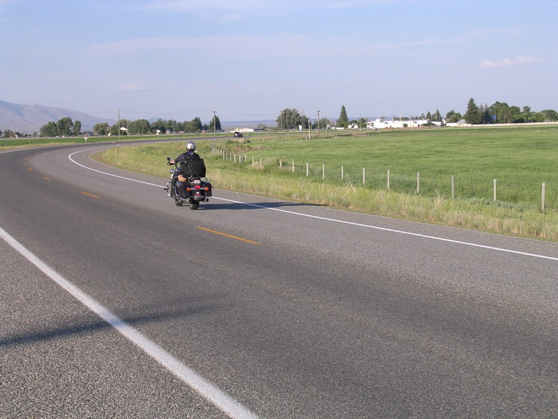
We left Lewiston a little before 8am and headed south on US 95. It was cool and a tad overcast. We climbed up to the Camas Prairie area of Idaho through the Nez Perce Indian Reservation. It started to sprinkle a little bit, making the air nice and cool, and as we were riding through some lush hay fields that had just been mowed, it smelled wonderful. One of the best things about being on the bikes are the smells. It's why dogs like to hang out the window when you drive -- the smells when riding are intense. Good and bad. The good ones, like rain dampened fresh hay, and sawdust at a sawmill far outweigh the occasional pulp mill or manure spreader.
The clouds appeared to be thickening up so we stopped and put on our rain gear. Riding in the wet isn't fun, and when one's clothes are wet to boot, its even more miserable.
 We just put on the jackets as it didn't appear that it would rain so much that our leather chaps wouldn't keep our legs dry, and we more or less had off again - on again sprinkles for quite some time. The Camas Prairie area is a stunningly lush and beautiful high prairie, and the ride was fantastic -- for about 160 miles.
Just as we started to climb up into the mountains near McCall we could see a rain squall up ahead, and before we knew it, we were riding in a downpour that soaked us through the leather, and we'd have been fine and dandy had we had snorkels to breathe with. We tended to stop every 30 miles or so at gas stations just to wipe off our glasses and shake off the water as best we could. When the storm suddenly ended just as we started to drop down into Boise, the sun came out, and we started to roast in our water-proof rain coats. When we hit a remote controlled signal (replacing a flagman at a construction site), we had just enough time to take them off and stuff them in the saddle bags before the light changed and we were moving. It was very hot by the time we hit Boise at 230p, and we needed to stop for lunch.
We found a nice diner in Eagle, just outside of Boise and sat down for a good lunch and rest. But as we were eating we could see one of those typical Western afternoon thunder storms, and sure enough, just as we left the diner it started to sprinkle and we could hear the thunder. It appeared however that we could get ahead of the storm, and so we aimed the bikes for the short stretch of I-84 that we had to take to get to Mountain Home. Unfortunately, we were wrong, and we got hit by the second downpour of the day just as we were getting onto the freeway and WITHOUT our rain gear on. The storm lasted all the way through Boise and it ended just as quickly as it started, and because it was hot and dry away from the storm, and we were riding along at 75 mph, we dried out rather quickly. It also washed off all the sun-screen we'd applied before leaving Boise -- not a good thing since our arms look like we dunked them into a vat of brown paint up to our elbows.
About 10 miles out of Boise traffic came to a dead stop -- apparently there was an accident a few miles up. Rather than sit idling on the freeway, we went up the shoulder to the nearest exit and a large Truck Stop. We stopped, put on more sun-screen, and checked the map. We found a back way to Mountain Home and decided to take it, and headed out over the freeway, which was still plugged up like a colicky baby.
This is high desert with lots of sagebrush -- and apparently Antelope too, as a small herd of 6 bounded across our path quite suddenly. As cool as it was, it was very unexpected and somewhat frightening since accidents with motorcycles and deer (and antelope too) are fairly common to those who ride in the country at night. I'm not sure how common in the high-desert in the middle of the day however.
We picked up US 20 east, and headed out. This road leads to the turn-off to Sun Valley, but it travels a very sparsely populated area and we made great time and the temperature cooled off and the riding was almost perfect.
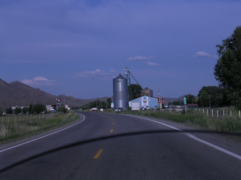 There were a few small towns along the route, each with a grain elevator and a gas station or two, and not much else. This road also took us along the northern edge of the Craters of the Moon National Monument. It really felt like we were on the moon -- miles from nowhere, and no plant life growing among the lava flows. The road was posted for some construction work back at the junction with the road to Sun Valley (and we'd been tempted to detour to Sun Valley and stay a night, but decided to keep going). The "construction" consisted of removing the entire road surface and replacing it with...nothing -- for 9 miles. Those were a long nine miles at 30mph and through gravel, sand, and rocks. We both felt like doing what the late Pope John Paul did and getting off the bikes and kissing the asphalt once it resumed.
Our original itinerary had us in Pocatello tonight, but we realized it was not going to be possible, given the construction zone, the accident on the freeway and the slow riding in the rain, so we settled on shooting for Arco, Idaho -- the First Town Powered By Atomic Energy according to the sign at City Hall. It also had only one motel that was a little to reminiscent of the Bates Motel for Tony's comfort, so although it was 9pm, we decided to try for Blackfoot. 66 miles further on, which sits on I-15 and would have, we hoped, a venerable plethora of accommodation to choose from.
The road from Arco south to Blackfoot has to be tied with US 6 in Nevada as the "Loneliest Stretch of Highway in the US". We didn't pass one car for 66 miles. However spooky it was, it was glorious as the sun was sinking over the high desert and the road was straight as an arrow and appeared to be disappearing into the horizon. There were only a few scattered lights of ranch buildings or mysterious "Area 51" kind of buildings for the Idaho National Laboratory, and had we been abducted by aliens it wouldn't have come as a surprise.
We finally got to Blackfoot a little before 10pm, and got a room at the Best Western and just finished a late dinner at the Sonic Drive In across the street. We are both ready for some sleep. In the morning we'll make the 4 hour run into Salt Lake and expect to be there by sometime mid-afternoon. It will be good to rest the bikes (and our butts) for a few days before meeting up with the Chorus and starting that part of the tour.
It's been a very long day -- and we've covered a lot of territory, and I think it's the longest day on the motorcycles we've ever spent, both in time and in miles. Time to hit the hay....
From the Best Western in Blackfoot, Idaho
Gary and Tony
posted by Tony Gilkinson @ 11:16 PM
0 Comments
![]()
![]()

0 Comments:
Post a Comment
Subscribe to Post Comments [Atom]
<< Home